Most of us have 19th Century rural ancestors, usually agricultural labourers working on farms. We may also have ancestors that owned or rented some land. If this is the case and if you have English or Welsh roots, then a really useful resource are tithe maps.
What is a Tithe?
Tithes were originally a tax paid annually to support the local church and clergy. They were paid in kind so one tenth of agricultural goods went to the church. Over the years, much of this land passed from the church to lay owners who then received the tithes.
By the early 1800s, this form of tax had become very unpopular, so in 1836 the Government passed the Tithe Commutation Act which required tithes to be paid in cash instead of goods. This was known as Tithe Rentcharge.
Why the Tithe Maps and Records were created
In order to determine which areas were subject to tithes, who owned them, how much should be paid and who should be paid, a Tithe Survey was carried out across England and Wales. Every parish was first contacted to see where payments were still made in kind and which ones had already been converted to cash.
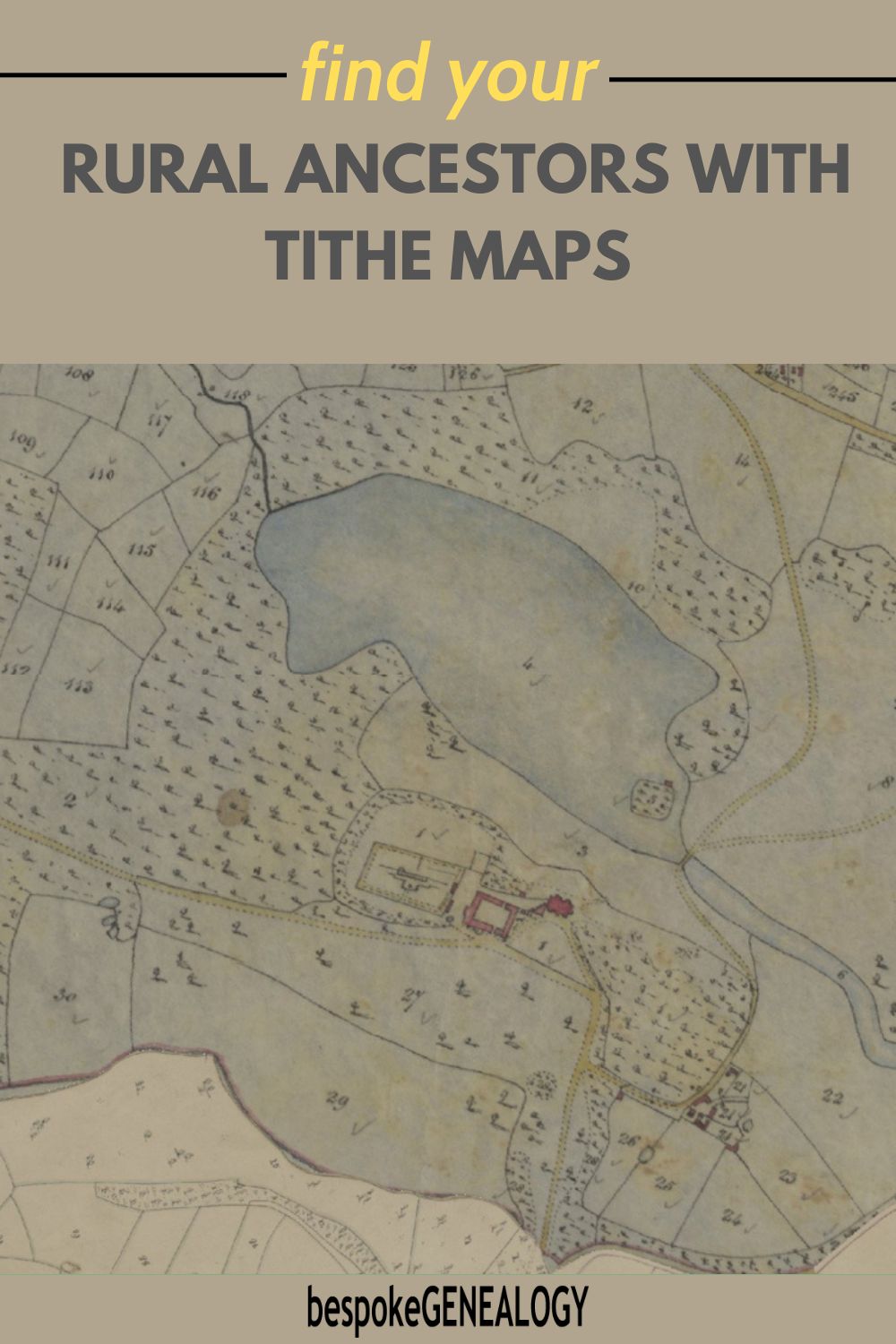
An assistant commissioner would then visit a parish where tithes were paid in kind and survey the area to determine a valuation. He would meet all parties and the end result would be a tithe apportionment document with the liabilities and rentcharge amount listed. This document was accompanied by a tithe map showing the details of the property.
Both the apportionment and the map used the same number to identify each property so that they could be cross-referenced. Once the parties agreed, the Tithe Commissioner would sign them both and the rent charge became payable.
Tithe Maps and Records on The Genealogist
The tithe maps and apportionments for England and Wales can be viewed online as part of a Diamond subscription to The Genealogist. You can search by name or parish. Note: not all parishes are covered as some had already been converted to cash payments before the survey, but most parishes were surveyed. Below is an example of a tithe apportionment.
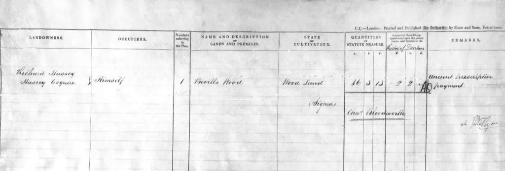
Tithe Apportionment for Bevill’s Wood, Huntingdonshire from The Genealogist.
This is for Bevill’s Wood in Huntingdonshire. The landowner and occupier is Richard Hussey Esq. It shows that the area in question is woodland and gives its exact size of 86 acres, 3 roods and 13 perches. Incidentally, there were 40 perches to a rood and 4 roods to an acre. The amount of Tithe Rentcharge was set at 4 pounds and 4 shillings per annum and was payable to the Rector of the village of Denton. All landowners and occupiers are shown on these documents, so if your ancestor was occupying just a small piece of land, if it was surveyed, he will appear as will his landlord. The tithe map that accompanies the Bevill’s Wood apportionment is shown below.
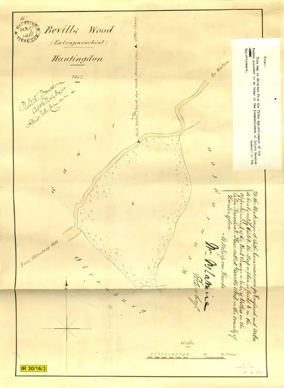
Tithe Map for Bevill’s Wood, Huntingdonshire from The Genealogist.
Using The Genealogist’s excellent Map Viewer, you can also see the tithe map on top of an old Ordnance Survey map to pinpoint where exact location of your ancestor’s property:
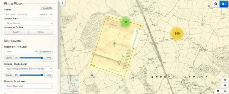
By moving the slider control on the Map Viewer, you can also see the tithe map on top of a modern map or satellite image:
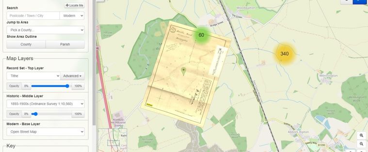
Incidentally if you have English ancestors, a subscription to The Genealogist is definitely worth considering. As well as tithe maps there are many other record sets available, including the most comprehensive collection of English parish registers of any database site. For a full list of the record sets available and to get a 10% discount, click here.
Other online sources of Tithe Records
If your rural ancestors were Welsh, then you can access tithe maps and apportionments free of charge at the National Library of Wales “Places of Wales” site here.
For more on Welsh resources see: The Best Welsh Genealogy Resources
Some English county archives also have free to access tithe records. Click on the links below to access:
- Cheshire
- Oxfordshire
- East Sussex
- Warwickshire (Tithe apportionments database only)
You may also be interested to know that historical maps for the whole of Britain can be accessed free of charge at the National Library of Scotland.
For more on this resource see: How to find free historical UK maps online
Happy mapping!
Please pin a pin to Pinterest:



Hello my name is Henry Farrow from the USA I’ve been searching the Farrows from mostly Norfolk England I’ve traced down 1588 and 1560 both with the name William Farrow can you tell me any resources or persons I can contact
Thank you for your time
Henry L Farrow
Hi Henry,
Well done for tracing your Farrow ancestors back to late 1500s Norfolk. Parish registers in this county go back to the early 1500s, so you may be able to get back a bit further with these records. However, note that some registers are missing and not all the surviving ones are online, so if you haven’t already done so, you need to determine whether registers survive for earlier dates in your parish and their location.
As I’m sure you know, Norfolk registers can be accessed on Family Search and Findmypast.
If you can’t find earlier parish registers online, you should contact the Norfolk Record Office where the original registers are held: https://www.archives.norfolk.gov.uk/ . They maybe able to do a look up or put you in touch with a local researcher who can help. They also have an online catalogue so you can search for other documents that may be of interest.
The Norfolk Family History Society may also be able to help: https://www.norfolkfhs.org.uk/
If your ancestors were ordinary farm workers, it is unlikely that you will be able to get back much further. However, if they were members of the aristocracy, the church or even wealthy commoners, you may find other documents. Again, the Norfolk Archives may have useful documents like land records and wills. See also my post on aristocratic roots for some links: https://bespokegenealogy.com/royal-ancestry/
Good luck with your research!
Thank you for the information it should be very helpful thank you
Henry Farrow
You’re welcome!
Hi I am researching the Pettibone. William Pettibone was in battle of angincourt in 1415. I did find a deed on him and his wife but would like to connect with the original Pettibone family that came to Ct in 1600s
Is this family related to the Jonathan Pettibone who owned Pettibone’s Tavern in Simsbury? https://historicbuildingsct.com/pettibones-tavern-1803/ .
Have you searched the online catalogue for Pettibone / Pettybone information on the UK National Archives website?: https://www.nationalarchives.gov.uk/ .
I see there are people researching Pettibones on WikiTree, have you looked there?: https://www.wikitree.com/genealogy/PETTIBONE
Also, have you checked the Pettibone family histories in the Books section on Family Search?: https://www.familysearch.org/library/books/records/?navigation=&perpage=&page=1&sort=_score&search=pettibone&fulltext=1&bookmarks=0#title
Cheers