What’s the Difference between the UK, Britain and England?

1901 Map of the British Isles.
There is often confusion about the differences between the UK, Great Britain, the British Isles and England.
The United Kingdom of Great Britain and Northern Ireland (UK) is the sovereign state. The UK contains the countries of England, Wales, Scotland and Northern Ireland. The British Isles is a geographical term referring to the UK plus Ireland, the Isle of Man and the Channel Islands. Great Britain, often just referred to as Britain, is the largest island in the British Isles. Britain contains England, Scotland and Wales.
This article looks at all these pieces with the help of some maps and flags.
United Kingdom (UK)
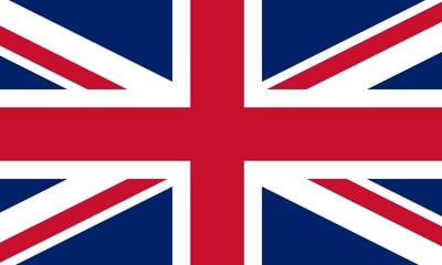
The United Kingdom of Great Britain and Northern Ireland is the official name of the sovereign state that is the member of the United Nations. It has the Union Flag (or Union Jack) as it’s official flag:
King Charles III is now the head of state of the UK, following the death of Queen Elizabeth in 2022. The UK is a constitutional monarchy and parliamentary democracy. The UK Parliament is situated in Westminster in London, the capital city.
The UK consists of England, Wales, Scotland and Northern Ireland. The United Kingdom originally came into being in 1801 when Ireland joined the Kingdom of Great Britain. The UK in its current form dates from 1922 when what’s now the Republic of Ireland achieved independence. Northern Ireland remained in the UK (see the section on Ireland, below). The UK does not include the Isle of Man and the Channel Islands (see below).
British Isles
The British Isles is a geographical term consisting of the two large islands of Great Britain and Ireland as well as the Isle of Man, the Channel Islands and over 6000 smaller islands in the archipelago. In the Republic of Ireland, the term British Isles is not normally used for obvious reasons. The Irish prefer to use terms such as “Britain and Ireland” or “British Islands and Ireland”.
Great Britain
Great Britain, or Britain, or even GB for short is the geographical term for the largest island in the British Isles. GB consists of England, Wales and Scotland. It was also a country in its own right, as the Kingdom of Great Britain which existed from 1707 until 1801 when Ireland joined to form the United Kingdom.
England
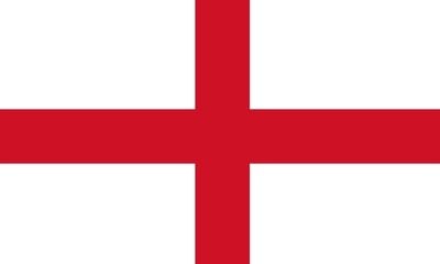
With a population of over 56 million and covering an area of 130,000 km2, England is the largest country within the United Kingdom. England’s flag is the St George Cross:

1890 Map of England and Wales
Unlike in Scotland, Wales and Northern Ireland, England does not have a devolved government, although several of its large cities and some regions do. All English laws are enacted in the UK parliament in Westminster.
Most of England and Wales were first united by the Romans who occupied the country for nearly 400 years, between AD 43 – 410. After the Romans left, England eventually reverted back to a collection of smaller Kingdoms.
The Kingdom of England was effectively founded in the 10th century after the smaller Kingdoms were united.
If you are researching your English family history, check out the English Ancestors page which has links to articles explaining the main record sets and sources you need to find your roots.
Wales
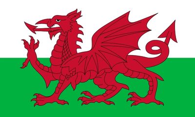
Wales is the second smallest country in the United Kingdom, with a population of just over 3 million and a land area of less than 21,000 km2. Wales has a devolved parliament called the Senedd which is in the Capital; the city of Cardiff. The official flag of Wales is the Red Dragon (or Y Ddraig Goch in Welsh):
Wales was effectively annexed into the Kingdom of England in the 16th century.
If you are researching your Welsh family history, check out the Welsh Ancestors page which has links to articles explaining the main record sets and sources you need to find your roots.
Scotland
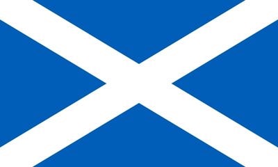
Scotland is the second largest country in the United Kingdom, both in terms of population (about 5.5 million) and land area (about 78,000 km2). It has a devolved parliament known as Holyrood. The official flag of Scotland is the Saltire:
The Kingdom of Great Britain was formed in 1707 which united Scotland with England and Wales.
If you are researching your Scottish family history, check out the Scottish Ancestors page which has links to articles explaining the main record sets and sources you need to find your roots.

1840 Map of Ireland
Ireland
Ireland had effectively been a British colony since the Tudor dynasty in the 16th century. However, parts of Ireland had been under Norman control as early as the 12th century. The country was united with the Kingdom of Great Britain in 1801 when the United Kingdom was formed.
Ireland was partitioned in 1922, with the south becoming independent and the north remaining in the United Kingdom.
Northern Ireland
After partition in 1922, the six Irish counties of Antrim, Down, Armagh, Derry (or Londonderry), Tyrone and Fermanagh remained in the United Kingdom as Northern Ireland. This is now the smallest country in the UK, with a population of just under 2 million and a land area of about 13,500 km2. It has a devolved assembly known as Stormont, in the Capital, Belfast. There is no official flag of Northern Ireland.
The Republic of Ireland
After the 1922 partition, the 26 counties that were not part of Northern Ireland became the Irish Free State, and from 1937, the Republic of Ireland or Eire.
The counties of the Republic are: Carlow, Cavan, Clare, Cork, Donegal, Dublin, Galway, Kerry, Kildare, Kilkenny, Laois, Leitrim, Limerick, Longford, Louth, Mayo, Meath, Monaghan, Offaly, Roscommon, Sligo, Tipperary, Waterford, Westmeath, Wexford and Wicklow.
Eire is a democratic parliamentary republic with an elected president as head of state. The National Parliament (or Oireachtas) is in the Capital city of Dublin. The population of the Republic is just over 5 million and the land area is about 70,000 km2.
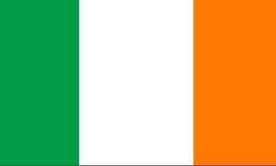
The official country flag of Ireland is the tricolour or Bratach na hÉireann:
If you are researching your Irish family history, check out the Irish Ancestors page which has links to articles explaining the main record sets and sources you need to find your roots.
Isle of Man
The Isle of Man sits in the Irish Sea, in between Great Britain and Ireland:
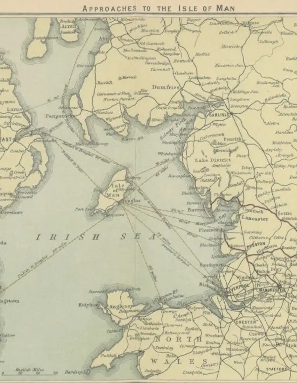
1896 Approaches to the Isle of Man Map
Although it’s in the British Isles, it is not part of the United Kingdom. The island is a British Crown Dependency, with King Charles as Head of State. The island is self governing apart from in the areas of defence and foreign policy which are the responsibility of the UK.
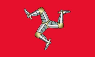
Tynwald is the name of the Isle of Man parliament which is in the Capital, Douglas. The official flag is the Manx Triskelion:
The population of the Isle of Man is 84,000 and the land area is 572 km2.
For family history resources see: How to find your Isle of Man Ancestors.
The Channel Islands
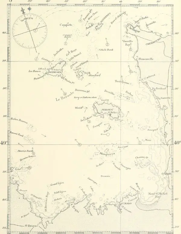
1897 Chart of the Channel Islands
The Channel Islands is a geographical term referring to a group of islands in the English Channel. Although these islands are closer to France than England, they are part of the British Isles, although not part of the United Kingdom. The islands are part of two British Crown Dependencies; the Bailiwicks of Jersey and Guernsey. The word bailiwick means a district under the jurisdiction of a bailiff.
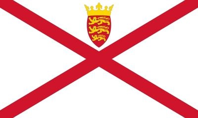
Bailiwick of Jersey
Jersey is the largest of the Channel Islands with a population of over 100,000 and a land area of 118 km2. Like the Isle of Man, Jersey is a British Crown Dependency and a self-governing democracy. Jersey’s parliament is called the States Assembly and is in the Capital, St Helier.
Jersey flag:
Bailiwick of Guernsey
The main inhabited islands of the Bailiwick of Guernsey are:
- Guernsey (population 63,000 – area 65 km2)
- Alderney (population 2,000 – area 8 km2)
- Sark (population 600 – area 5.5 km2)
There is no flag for the Bailiwick of Guernsey, but this is the one for the island of Guernsey:
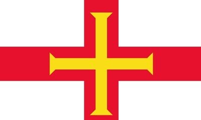
The parliament is the States of Guernsey in Saint Peter Port.
Recap
To recap, the United Kingdom contains the countries of England, Wales, Scotland and Northern Ireland. Great Britain, or Britain refers to the large island that contains England Wales and Scotland. The Isle of Man and the Channel Islands are not in the UK, but are part of the British Isles which is a geographical term for all of the islands.
Pinterest Pin:

